Finding and saving GIS services
The detector is the part of Geo Hound that watches your browsing and catches the GIS services behind the maps you look at. You do not have to do anything to make it work.
Install, then browse
Install the extension, then open any site with a web map on it: a council viewer, a government portal, a hazard map. As the page loads its data, the number on the Geo Hound toolbar icon starts counting.
That badge counts the services in your Default folder plus the ones just found in this browser session. Services you have filed into your own folders are not counted.
What it catches
The detector recognises OGC services (WMS, WFS, WMTS, WCS), the newer OGC API family (Features, Tiles, Maps, Coverages, Processes, Records, Styles, EDR, Routes, and 3D GeoVolumes), the Esri ArcGIS REST family (MapServer, FeatureServer, ImageServer, GPServer, GeometryServer, GeocodeServer, VectorTileServer), and tile endpoints (XYZ tiles, vector tiles, and vector tile styles).
It also picks up geospatial files linked on the page: GeoJSON, KML and KMZ, shapefiles, GeoTIFF, and GeoPackage.
Beyond watching network traffic, it reads links and text on the page, and inspects live Leaflet and MapLibre maps directly to see what layers they have registered.
Some things are deliberately ignored so the list stays useful: the big commercial basemap providers, localhost and private network addresses, and internal-only hostnames.
Opening the popup
Click the toolbar icon. Each service found appears as a card showing its name, its type, and a preview of its metadata: the title, the provider, how many layers, how many coordinate systems, a CORS chip if it supports cross-origin requests, and its keywords.
Newly detected services are marked Temporary. They live in session storage and disappear when you restart your browser unless you keep them. Click Keep on a card to make it permanent, or Save all... to move the whole batch into a folder.
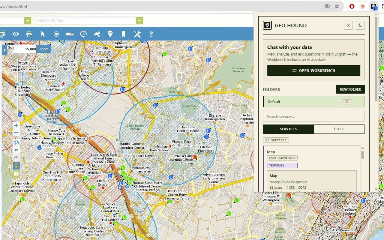
What a service card shows
Click Details on any card for the full record. Under Service Metadata you get the title, provider, description, the layer list behind a Show Layers button, keywords, supported formats, and supported coordinate systems (the first ten, then a count of the rest). Geographic coverage shows the bounding box.
Metadata is fetched automatically when a service is found, by asking the service to describe itself. Tile services get no metadata: there is nothing to ask.
The CORS test
CORS decides whether a service will load in a browser-based map. A service can work perfectly in QGIS and still refuse to load in a web app, and this test tells you which you are dealing with before you waste an afternoon.
Click Test CORS in the details dialog. The result appears as a badge:
| Badge | Meaning |
| --- | --- |
| Not Tested | No test has been run yet |
| Enabled | The service sends the header a browser app needs |
| Disabled | It does not |
| Fully Compatible | A tile service with CORS enabled |
| Web Map Compatible | A tile service that works for web maps |
| Test Failed | The test could not complete |
Once tested, the dialog also shows the allowed origin, the allowed methods, and when it was last checked. Re-test CORS runs it again.
One subtlety worth knowing: the extension holds permission to read all sites, which
means its own requests are not subject to CORS. So a request succeeding proves nothing.
The verdict is based purely on whether the service returns the
access-control-allow-origin header a real web app would need.
Copying for QGIS and ArcGIS Pro
Every card has three buttons: Copy URL, QGIS, and ArcGIS. One click puts the right form of the URL on your clipboard. The same URLs are in the details dialog under Normalized URLs, each with its own Copy button.
They differ because the two applications want different things:
- QGIS gets an Esri URL trimmed back to the server endpoint, or an OGC URL with the
right
GetCapabilitiesrequest and version already on it (WMS 1.3.0, WFS 2.0.0, WCS 2.0.1, WMTS 1.0.0). Tile templates keep their{z}/{x}/{y}placeholders. - ArcGIS Pro gets an Esri URL with
?f=json, and tile templates rewritten to Pro's own syntax:{level},{col},{row}.
To use one in QGIS: copy with the QGIS button, then in QGIS open the Browser panel, right-click the matching connection type (WMS/WMTS, WFS, or ArcGIS REST Servers), choose New Connection, and paste.
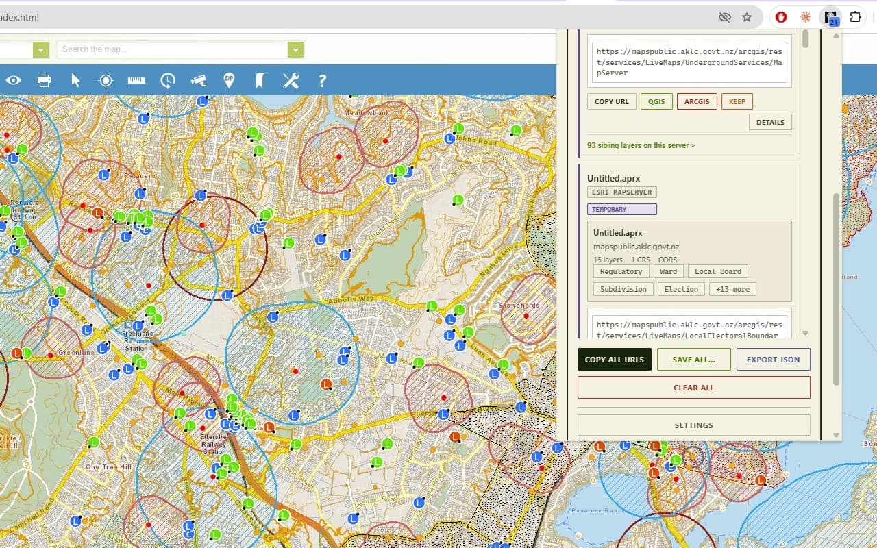
Folders and search
Services start in Default. Make more with New Folder, rename or delete them from the folder chips, and move a service with Move to Folder in its details dialog.
The search box matches, case-insensitively, across a service's name, type, URL, your
notes, its title, its provider, its keywords, and its layer names. So searching
parcels finds a service whose layer is called parcels even if its title says something
else entirely.
Silencing noisy sites
Some sites will fill your list with services you do not care about. Click Settings in the popup, then add an entry under Disabled URLs. There are three kinds:
- Exact Pattern matches anywhere in the whole URL, as a substring. Despite the name
it is not an exact match:
maps.internal-company.com/arcgiswill silence anything containing that text. - Domain matches the hostname, including subdomains. Enter it bare, with no
http://and nowww. - Wildcard Pattern matches the hostname with
*standing in for anything, such as*.internal.company.com. A wildcard containing a path will never match, because only the hostname is tested.
Anything matching is skipped before it is recorded at all.
Copying and exporting the lot
Copy All URLs puts every service in the current folder on the clipboard, one per
line, in its QGIS form. Export JSON downloads them as
gis-services-<folder>.json, each record carrying the type, the original URL, the
normalized URL, your custom name and notes, the timestamp, where it was discovered, and
both the QGIS and ArcGIS forms.
Both work on the folder you are looking at. On Default, they include the temporary session services too.
Downloading data for an area of interest
Some services will hand you their data directly. In the details dialog, a Download... button appears for WFS, WMS, OGC API services, and Esri FeatureServer and MapServer layers. Other types have no download button, because there is nothing to download.
- Click Details, then Download....
- Pick a Layer, if the service has more than one.
- Choose an Output CRS. The default is EPSG:4326.
- Click Draw bbox to open a small map, then Click & drag on map to draw and drag
out a rectangle. The bounding box appears underneath as
BBOX · W, S, E, N. Clear removes it. - For vector services, narrow it further with the filter builder, or write a WHERE clause by hand with Edit manually. The count line tells you how many features you are about to get, and Refresh recounts.
- Click Start Download. You get a GeoJSON file.
WMS is the exception, because it serves pictures rather than features. The dialog swaps the filters for image format and size controls, and the button becomes Export image. A bounding box is required.
OGC API Features services use the bounding box only: the WHERE clause is disabled.
The 500 limit
Geo Hound keeps at most 500 saved services in total. Past that, the oldest auto-detected ones are quietly trimmed to make room, and they can be found again later if you revisit the site.
Services you have filed into your own folders are never trimmed. If you care about something, put it in a folder and it will not be touched.